
Rancho Cucamonga, CA
Stop on the proposed 17,000-mile maglev network. Next stop: Ontario, CA (4.4 mi).
About Rancho Cucamonga
Rancho Cucamonga was a 13,045-acre Mexican land grant in present-day San Bernardino County, California, given in 1839 to the dedicated soldier, smuggler and politician Tiburcio Tapia by Mexican governor Juan Bautista Alvarado. The grant formed parts of present-day California cities Rancho Cucamonga and Upland. It extended easterly from San Antonio Creek to what is now Hermosa Avenue, and from today's Eighth Street to the mountains.
Source: Wikipedia summary (full article). Population and facts as published there.
Cost breakdown (proposal-scale estimates — see math)
| Item | Basis | Estimate |
|---|---|---|
| Terminal construction | Large-city terminal ($2–4B range) | $3.0B |
| Land acquisition | Regional factor 1.5× on $200M base | $300M |
| Track: Rancho Cucamonga → Ontario | 4.4 mi × $500M/mi | $2.2B |
| Annual operations (share) | 2% of $3.0B terminal | $60M/yr |
| Stop total (excl. annual ops) | $5.5B |
Best terminal location (proposed)
The Rancho Cucamonga Metrolink / Ontario Airport-adjacent district. The Rancho Cucamonga Metrolink station sits at the foot of the San Gabriels, minutes from Ontario International Airport. The surrounding commercial corridor has large parcels suitable for an airport-connector terminal. The catchment is the west IE's 800,000+ residents plus ONT's 7 million annual passengers — an airport link would multiply the terminal's value.
Before / after
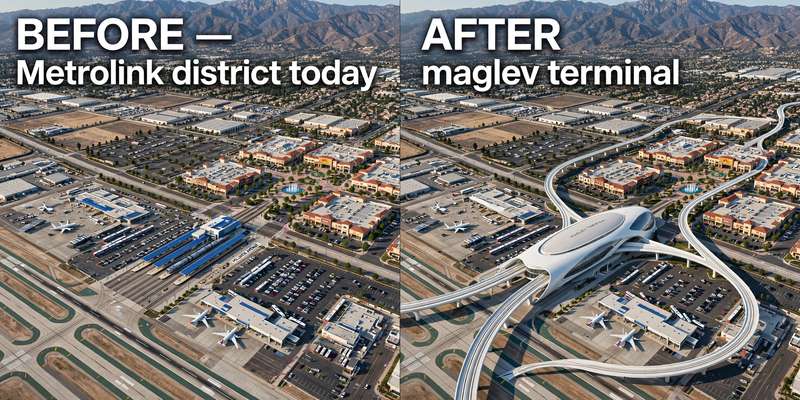
Aerial mock-up (illustrative, not an engineering rendering). Left: the proposed site today. Right: with the maglev terminal.
- Ontario Airport edge — airport-connector zone on the approach.
- Guasti — historic winery district between the two stations.