
Richmond, CA
Stop on the proposed 17,000-mile maglev network. Next stop: Berkeley, CA (6.0 mi).
About Richmond
Richmond is a city in western Contra Costa County, California, United States. The city was incorporated on August 3, 1905, and has a city council. Located in the San Francisco Bay Area's East Bay region, Richmond borders San Pablo, Albany, El Cerrito and Pinole in addition to the unincorporated communities of North Richmond, Hasford Heights, Kensington, El Sobrante, Bayview-Montalvin Manor, Tara Hills, and East Richmond Heights, and for a short distance San Francisco on Red Rock Island in the San Francisco Bay.
Source: Wikipedia summary (full article). Population and facts as published there.
Cost breakdown (proposal-scale estimates — see math)
| Item | Basis | Estimate |
|---|---|---|
| Terminal construction | Large-city terminal (range $2–4B) | $3B |
| Land acquisition | Regional factor 1.5× on $200M base | $300M |
| Track: Richmond → Berkeley | 6.0 mi × $500M/mi | $3.0B |
| Annual operations (share) | Staffing, power, maintenance | $60M/yr |
| Stop total (excl. annual ops) | $6.3B |
Best terminal location (proposed)
the Richmond Transit Center (BART/Amtrak intermodal). Richmond's transit center already stacks BART, Capitol Corridor and Amtrak in one station — the East Bay's only true intermodal hub. The surrounding industrial lands offer room to build. It serves west Contra Costa County plus a direct link for Marin commuters via the Richmond–San Rafael Bridge corridor.
Before / after
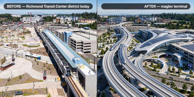
Aerial mock-up (illustrative, not an engineering rendering). Left: the proposed site today. Right: with the maglev terminal.
- El Cerrito — dense small city on the BART corridor between the two.
- Albany — small waterfront city approaching Berkeley.