
Spokane, WA
Stop on the proposed 17,000-mile maglev network. Next stop: Bellevue, WA (222.3 mi).
About Spokane
Spokane is a city in and the county seat of Spokane County in the U.S. state of Washington. It lies along the Spokane River, adjacent to the Selkirk Mountains and west of the Rocky Mountain foothills, 110 miles (180 km) south of the Canadian border, twenty miles (30 km) west of the Idaho state line, 279 miles (449 km) southwest of Calgary, and 280 miles (450 km) east of Seattle, via I-90.
Source: Wikipedia summary (full article). Population and facts as published there.
Cost breakdown (proposal-scale estimates — see math)
| Item | Basis | Estimate |
|---|---|---|
| Terminal construction | Mid-size city terminal ($1–2B range) | $1.5B |
| Land acquisition | Regional factor 1.5× on $200M base | $300M |
| Track: Spokane → Bellevue | 222.3 mi × $500M/mi | $111.2B |
| Annual operations (share) | 2% of $1.5B terminal | $30M/yr |
| Stop total (excl. annual ops) | $113.0B |
Best terminal location (proposed)
The Spokane Intermodal Center district. The Intermodal Center already hosts Amtrak's Empire Builder and the STA transit hub in downtown Spokane. The rail corridor through the city center offers a natural guideway path with minimal land takes. The catchment is the Inland Northwest — 600,000+ in the metro plus the region's medical, university, and agricultural economy — currently 5+ hours from Seattle by car.
Before / after
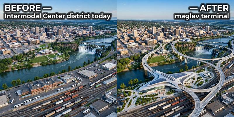
Aerial mock-up (illustrative, not an engineering rendering). Left: the proposed site today. Right: with the maglev terminal.
- Moses Lake — Columbia Basin ag and aerospace city on I-90.
- Ellensburg — Central Washington University town on I-90.
- Snoqualmie Pass — mountain resort corridor on the Cascade crossing.