
Virginia Beach, VA
Stop on the proposed 17,000-mile maglev network. Next stop: Norfolk, VA (17.0 mi).
About Virginia Beach
Virginia Beach is the most populous city in the U.S. commonwealth of Virginia. The city is located on the Atlantic Ocean at the mouth of the Chesapeake Bay in southeastern Virginia. It is the sixth-most populous city in the Mid-Atlantic and the Northeast, ninth-most populous in the Southeast, and the 43rd-most populous city in the U.S. with a population of 459,470 at the 2020 census.
Source: Wikipedia summary (full article). Population and facts as published there.
Cost breakdown (proposal-scale estimates — see math)
| Item | Basis | Estimate |
|---|---|---|
| Terminal construction | Large city — metro tier (range $2–4B) | $3B |
| Land acquisition | Regional factor 1.5× on $200M base | $300M |
| Track: Virginia Beach → Norfolk | 17.0 mi × $500M/mi | $8.5B |
| Annual operations (share) | Staffing, power, maintenance | $60M/yr |
| Stop total (excl. annual ops) | $11.8B |
Best terminal location (proposed)
A greenfield site at the I-264/I-64 interchange (Newtown Road area). The Newtown Road interchange sits on the seam between Virginia Beach and Norfolk, where highway access is best and a greenfield build avoids the costliest urban land takes. It would capture beach tourism traffic off I-264 and commuter demand from the region's largest employment centers, with bus connections feeding the Oceanfront.
Before / after
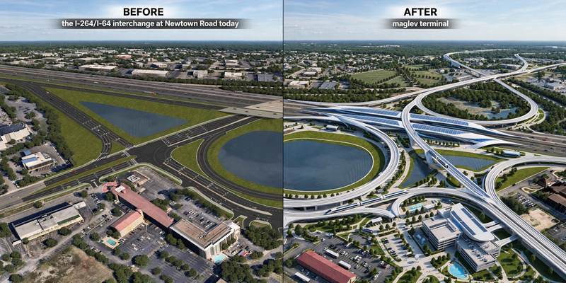
Aerial mock-up (illustrative, not an engineering rendering). Left: the proposed site today. Right: with the maglev terminal.
- Bayside (Virginia Beach) — dense residential and commercial node on I-264.
- East Beach (Norfolk) — waterfront residential district near the city line.
- Wards Corner (Norfolk) — historic commercial hub on the corridor.