
Charleston, SC
Stop on the proposed 17,000-mile maglev network. Next stop: North Charleston, SC (5.8 mi).
About Charleston
Charleston is the most populous city in the U.S. state of South Carolina. The city lies just south of the geographical midpoint of South Carolina's coastline on Charleston Harbor, an inlet of the Atlantic Ocean formed by the confluence of the Ashley, Cooper, and Wando rivers. Charleston had a population of 150,227 at the 2020 census, while the Charleston metropolitan area, comprising Berkeley, Charleston, and Dorchester counties, has an estimated 870,000 residents.
Source: Wikipedia summary (full article). Population and facts as published there.
Cost breakdown (proposal-scale estimates — see math)
| Item | Basis | Estimate |
|---|---|---|
| Terminal construction | Mid-size city — metro tier (range $1–2B) | $1.5B |
| Land acquisition | Regional factor 1.5× on $200M base | $300M |
| Track: Charleston → North Charleston | 5.8 mi × $500M/mi | $2.9B |
| Annual operations (share) | Staffing, power, maintenance | $30M/yr |
| Stop total (excl. annual ops) | $4.7B |
Best terminal location (proposed)
The upper Meeting Street corridor north of the historic district. The upper Meeting Street corridor offers commercial land outside Charleston's protected historic district, with direct road access to downtown, the port, and the medical district. The terminal would serve the region's tourism economy while keeping heavy infrastructure clear of the peninsula's most sensitive fabric.
Before / after
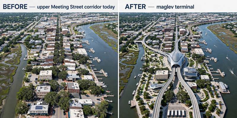
Aerial mock-up (illustrative, not an engineering rendering). Left: the proposed site today. Right: with the maglev terminal.
- Park Circle (North Charleston) — historic garden suburb.
- The Ashley-Phosphate corridor — commercial node on the route.
- The Neck area (Charleston) — redeveloping industrial district.