
Columbus, GA
Stop on the proposed 17,000-mile maglev network. Next stop: Atlanta, GA (95.5 mi).
About Columbus
Columbus is a consolidated city-county located on the west-central border of the U.S. state of Georgia. Columbus lies on the Chattahoochee River directly across from Phenix City, Alabama. It is the county seat of Muscogee County, with which it officially merged in 1970; the original merger excluded Bibb City, which joined in 2000 after dissolving its own city charter.
Source: Wikipedia summary (full article). Population and facts as published there.
Cost breakdown (proposal-scale estimates — see math)
| Item | Basis | Estimate |
|---|---|---|
| Terminal construction | Mid-size city — metro tier (range $1–2B) | $1.5B |
| Land acquisition | Regional factor 1.0× on $200M base | $200M |
| Track: Columbus → Atlanta | 95.5 mi × $500M/mi | $47.8B |
| Annual operations (share) | Staffing, power, maintenance | $30M/yr |
| Stop total (excl. annual ops) | $49.5B |
Best terminal location (proposed)
The downtown riverfront district near the Chattahoochee. Columbus's riverfront has been the focus of two decades of redevelopment, with industrial parcels near the existing rail lines. The terminal would serve Fort Moore's large military population and the Chattahoochee Valley, with the corridor east toward Atlanta following US-80/I-185.
Before / after
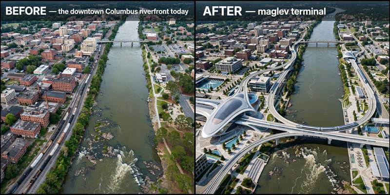
Aerial mock-up (illustrative, not an engineering rendering). Left: the proposed site today. Right: with the maglev terminal.
- Phenix City, AL — twin city across the Chattahoochee River.
- LaGrange, GA — Troup County seat on I-85.
- Newnan, GA — Coweta County hub on the I-85 corridor.