
Miami Gardens, FL
Stop on the proposed 17,000-mile maglev network. Next stop: Miramar, FL (3.4 mi).
About Miami Gardens
Miami Gardens is a city in north-central Miami-Dade County, Florida, United States. It is a suburb of Miami and located 16 miles (26 km) north of downtown Miami with city boundaries that stretch from I-95 and Northeast 2nd Avenue to its east to Northwest 47th and Northwest 57th Avenues to its west, and from the Broward County line to its north to 151st Street to its south. The city's name originated from Florida State Road 860, a major roadway through the area also known as Miami Gardens Drive.
Source: Wikipedia summary (full article). Population and facts as published there.
Cost breakdown (proposal-scale estimates — see math)
| Item | Basis | Estimate |
|---|---|---|
| Terminal construction | Large city — metro tier (range $2–4B) | $3B |
| Land acquisition | Regional factor 1.5× on $200M base | $300M |
| Track: Miami Gardens → Miramar | 3.4 mi × $500M/mi | $1.7B |
| Annual operations (share) | Staffing, power, maintenance | $60M/yr |
| Stop total (excl. annual ops) | $5B |
Best terminal location (proposed)
The Hard Rock Stadium district at the Turnpike. The Hard Rock Stadium district draws millions annually for the Dolphins, Hurricanes, the Miami Open, and F1 — event demand few other stops can match. With the Turnpike and I-95 nearby, the terminal would serve northern Miami-Dade's dense residential base year-round.
Before / after
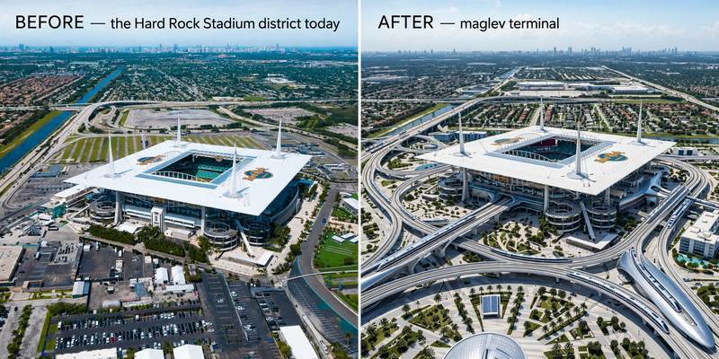
Aerial mock-up (illustrative, not an engineering rendering). Left: the proposed site today. Right: with the maglev terminal.
- The Country Club district (Miami Gardens) — residential area on the corridor.
- Opa-locka, FL — historic city on the route.
- Silver Lakes (Miramar) — suburban community to the south.