
Reno, NV
Stop on the proposed 17,000-mile maglev network. Next stop: Roseville, CA (95.6 mi).
About Reno
Reno is a city in the northwest section of the U.S. state of Nevada, along the Nevada–California border. It is the county seat and most populous city of Washoe County. Sitting in the High Eastern Sierra foothills, in the Truckee River valley, on the eastern side of the Sierra Nevada, it is about 23 miles (37 km) northeast of Lake Tahoe.
Source: Wikipedia summary (full article). Population and facts as published there.
Cost breakdown (proposal-scale estimates — see math)
| Item | Basis | Estimate |
|---|---|---|
| Terminal construction | Mid-size city terminal ($1–2B range) | $1.5B |
| Land acquisition | Regional factor 1.0× on $200M base | $200M |
| Track: Reno → Roseville | 95.6 mi × $500M/mi | $47.8B |
| Annual operations (share) | 2% of $1.5B terminal | $30M/yr |
| Stop total (excl. annual ops) | $49.5B |
Best terminal location (proposed)
The downtown Reno Amtrak station district. Reno's downtown station already hosts the California Zephyr in a rail trench that threads the city center. The 4th Street transit center and surrounding redevelopment parcels give a buildable downtown footprint. The catchment is the Truckee Meadows plus ski and Tahoe tourism — and it's the only trans-Sierra passenger corridor, via the historic Donner/I-80 route.
Before / after
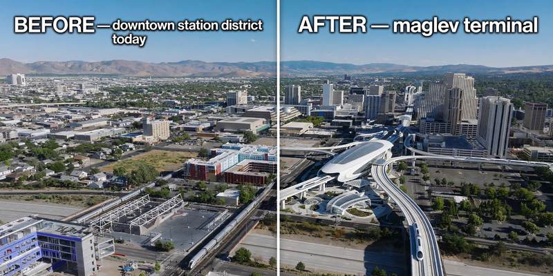
Aerial mock-up (illustrative, not an engineering rendering). Left: the proposed site today. Right: with the maglev terminal.
- Truckee — mountain resort town on the trans-Sierra corridor.
- Colfax — Gold Rush foothill town on I-80.
- Auburn — foothill city at the Sierra gateway.