
Roseville, CA
Stop on the proposed 17,000-mile maglev network. Next stop: Sacramento, CA (16.1 mi).
About Roseville
Roseville is the most populous city in Placer County, California, located within the Sacramento metropolitan area. At the 2020 census, the city's population was 147,773, making it the third-largest city in the Sacramento area. Interstate 80 runs through Roseville and State Route 65 runs through part of the northern edge of the city.
Source: Wikipedia summary (full article). Population and facts as published there.
Cost breakdown (proposal-scale estimates — see math)
| Item | Basis | Estimate |
|---|---|---|
| Terminal construction | Large-city terminal (range $2–4B) | $3B |
| Land acquisition | Regional factor 1.5× on $200M base | $300M |
| Track: Roseville → Sacramento | 16.1 mi × $500M/mi | $8.1B |
| Annual operations (share) | Staffing, power, maintenance | $60M/yr |
| Stop total (excl. annual ops) | $11.4B |
Best terminal location (proposed)
the historic downtown Roseville Amtrak station district. Roseville's depot serves the Capitol Corridor with the largest park-and-ride footprint in the Sacramento region, and the Union Pacific yard corridor gives a ready alignment. Historic downtown is walkable and primed for transit-oriented infill. It captures Placer County's fast-growing suburbs plus I-80 corridor commuters.
Before / after
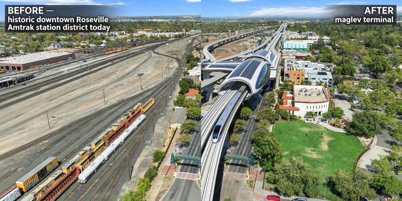
Aerial mock-up (illustrative, not an engineering rendering). Left: the proposed site today. Right: with the maglev terminal.
- Citrus Heights — large suburb on the I-80 corridor between the two.
- North Highlands — unincorporated community midway on the alignment.
- The Watt Avenue corridor (Sacramento) — dense commercial strip approaching downtown.